Solarium™
SeisMomentum’s own interactive 3D platform for seismic, well and microseismic data, and the engine behind our seismic merging workflow.
Built by geophysicists, for real projects
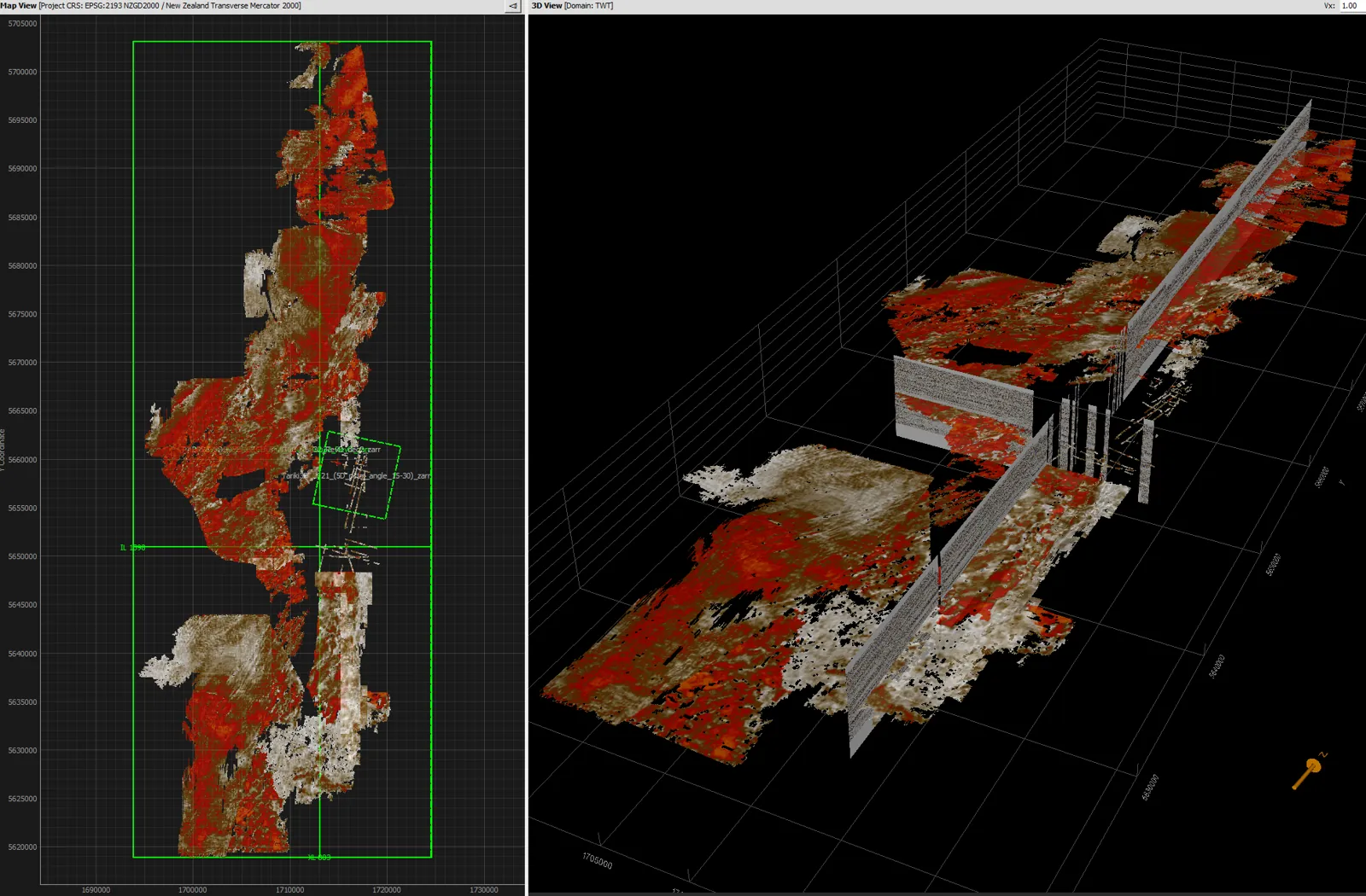
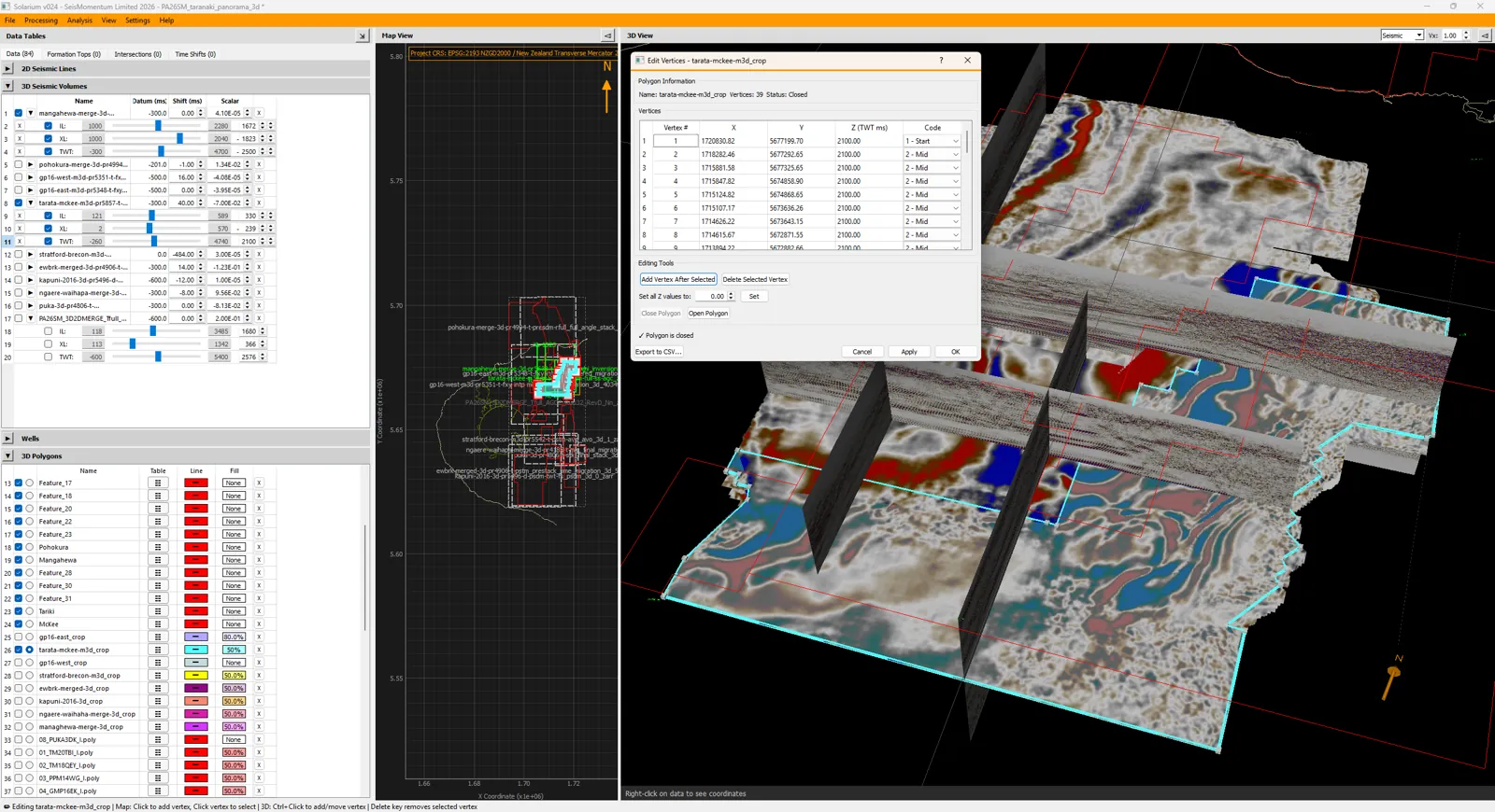
Mainstream interpretation packages are powerful, but they are rarely built to handle dozens of mismatched surveys at once. We built Solarium™ to fill that gap. It loads 2D lines and 3D volumes of any vintage into a single map-and-3D workspace. There, we can crop, scale, shift, phase-rotate and spectrally match each survey against its neighbours, then export the matching parameters straight into our Seismic Un*x merging workflow.
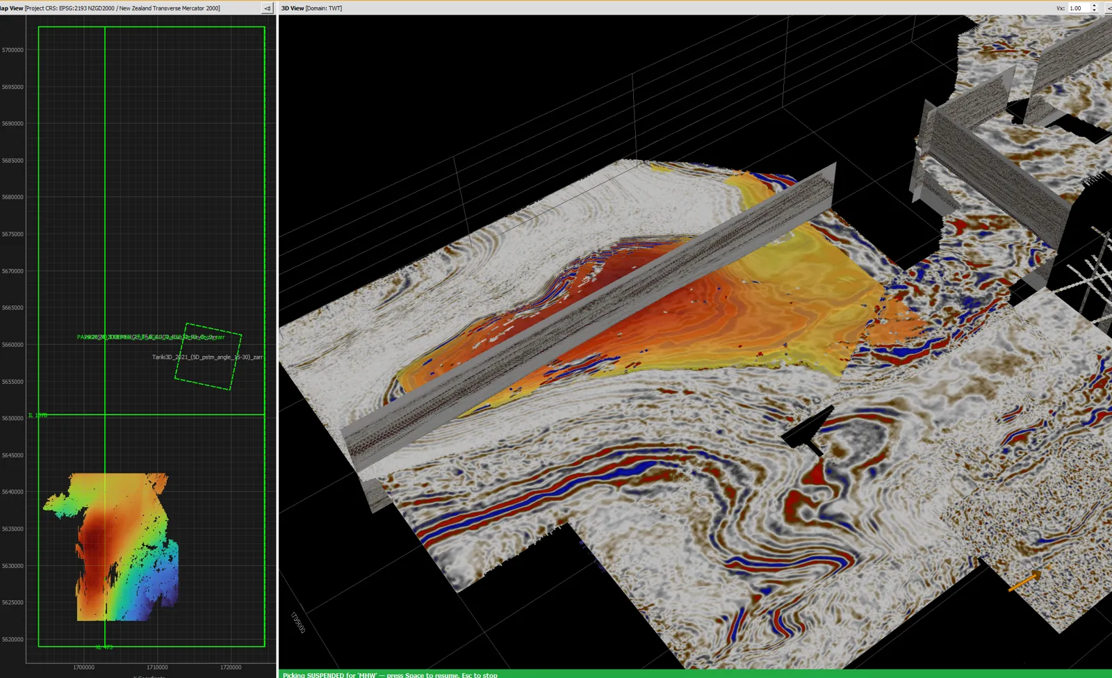
Since then Solarium™ has grown into a broader geoscience platform. It now covers wells, logs, formation tops, horizon and fault interpretation, gridding, microseismic analysis and borehole survey design, all in one fast, GPU-accelerated 3D view.
Solarium™ is written in Python using VTK and Qt, and was developed with the help of Anthropic’s Claude AI.
What Solarium™ does
Seismic data
Imports 2D and 3D SEG-Y and SU, with fast Zarr storage for large volumes. Interactive inline, crossline and time slicing, cropping and subsampling.
Survey matching
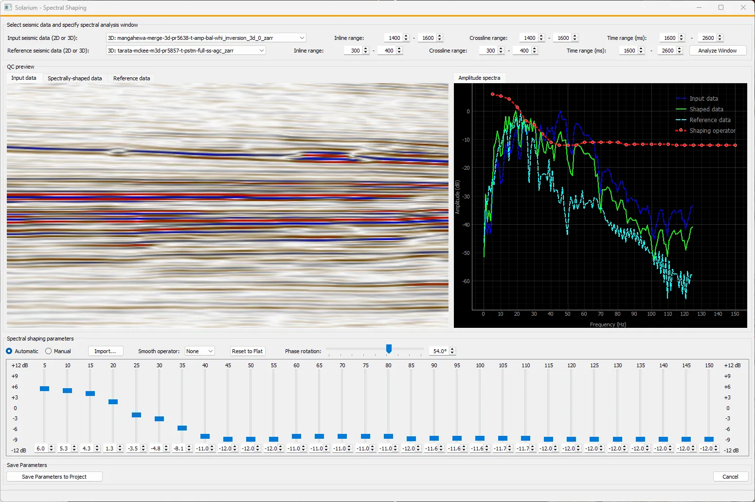
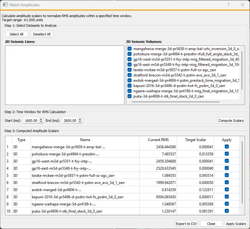
RMS amplitude matching, time-shift solving, polarity and phase rotation, and spectral shaping. Parameters are exported directly for Seismic Un*x.
Wells & logs
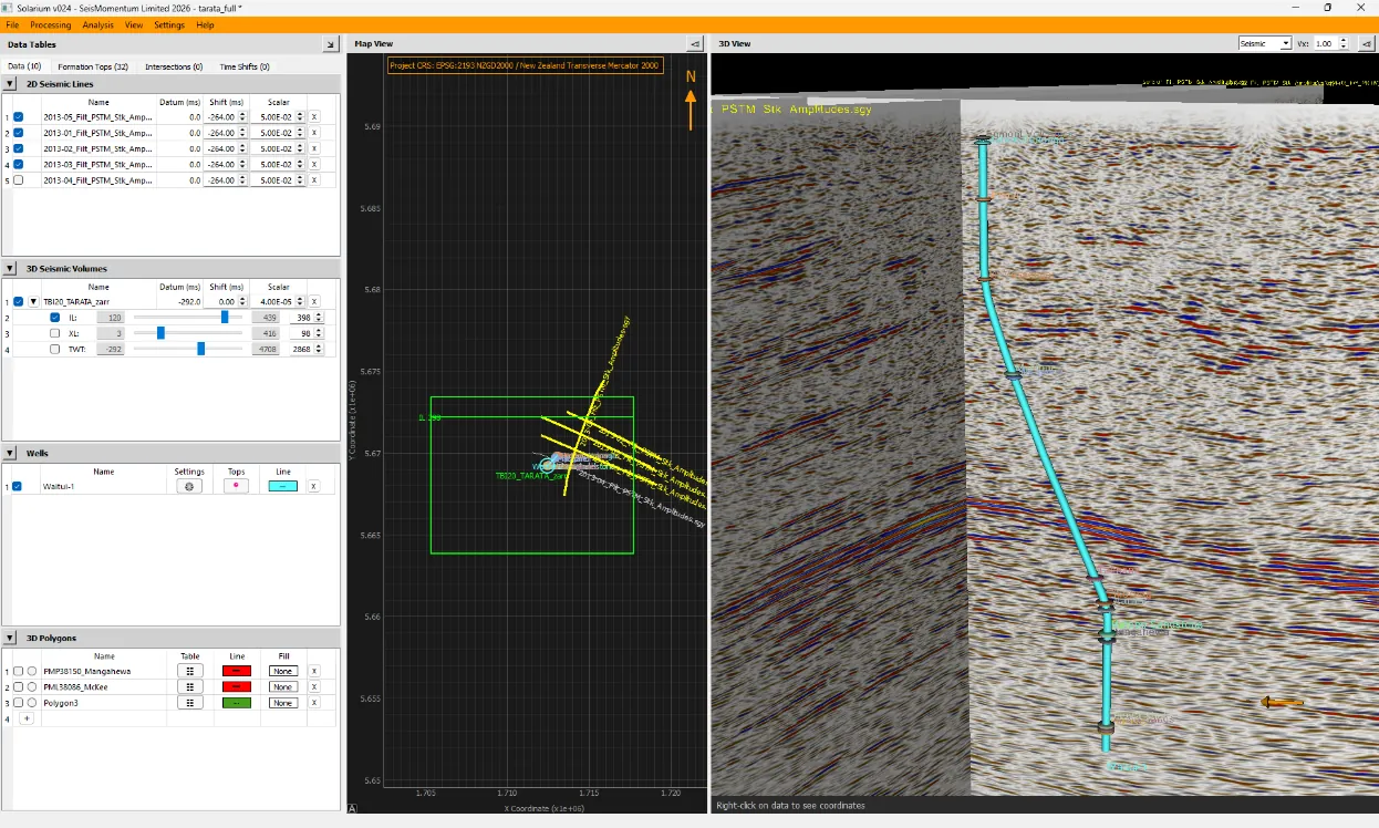
Well trajectories, LAS and ASCII logs, formation tops, time–depth relationships and seismic-to-well ties with wavelet import and export.
Interpretation
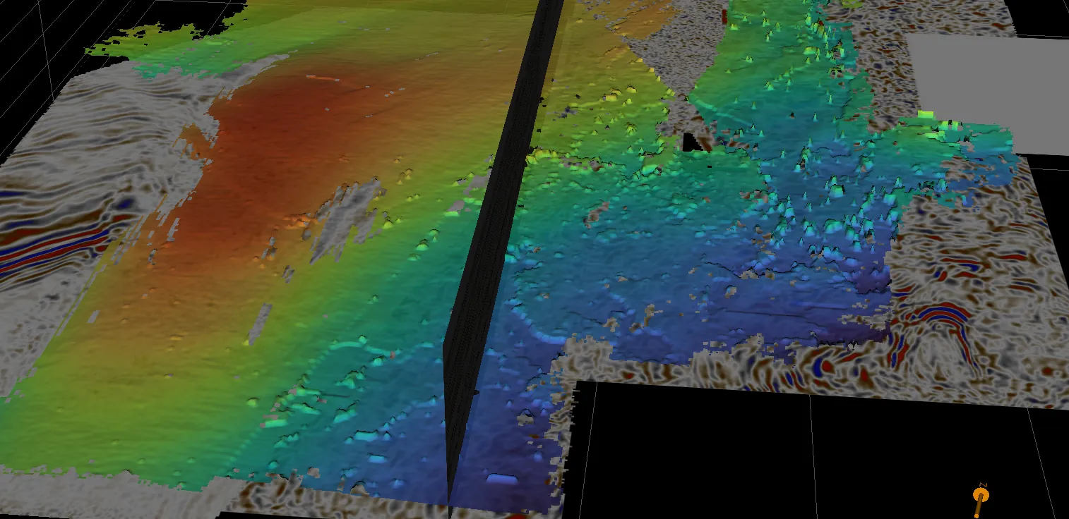
Horizon picking with autotracking, fault sticks and fault surfaces, gridding and tri-meshes, with export to GoCAD, ZMAP+, Irap and ESRI formats.
Microseismic & point data
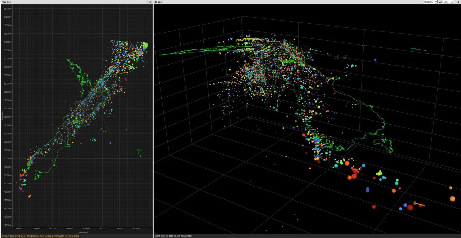
Microseismic event and point-set import (for example earthquake catalogues), filtering, statistics, clustering, time-lapse playback and r–t diffusivity analysis.
Borehole survey design
VSP design and 3D two-point ray-tracing through velocity models, including DAS sensitivity for fibre-optic acquisition.
Maps & geospatial
Project coordinate reference systems, shapefile and polygon import, and interactive polygon editing for cropping and QC.
Performance
Optional CUDA GPU acceleration, cached textures and deferred rendering keep basin-scale datasets interactive on a desktop PC.
Solarium™ in action